
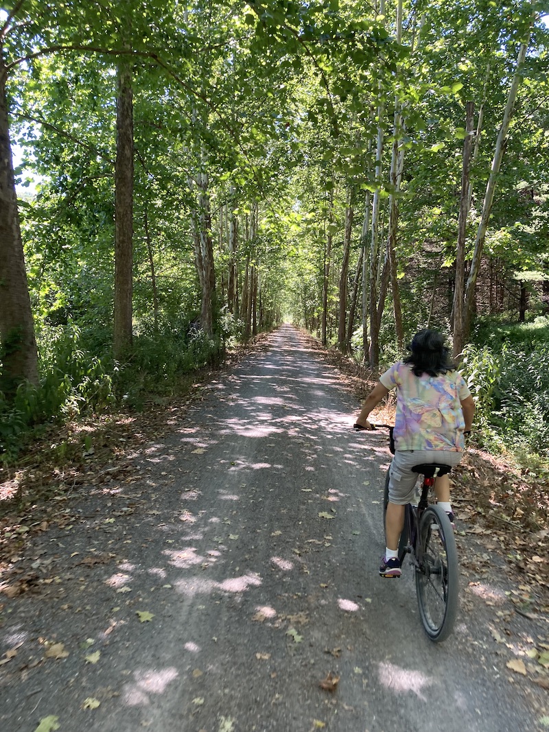
Biking Pennsylvania’s Pine Creek Rail Trail: 62 Miles of Adventure
Skip to Section
For hikers and bikers, the popularity of rails-to-trails rests on three truths:
First, these routes are mostly flat, since trains can’t climb steep grades; second, in rough or rugged terrain, railroads tend to follow scenic waterways; and third, they often go where cars do not.

All of this is proven by the world-famous Pine Creek Rail Trail, 62 miles of biking heaven in the wilds of Northcentral Pennsylvania.
Opened in 1996 and completed 11 years later, the PCRT runs on the abandoned and almost perfectly level roadbed of the former New York Central line ending at Lyons, NY—which explains the “L” on mileposts that still stand sentry along the bike-path. Often short on stores, auto access and cell service, the trail’s terrain includes creek-sides, roadsides, cliffsides, marshes, meadows, farmland, fern-filled forests—and 16 miles of the Pennsylvania Grand Canyon, a gorgeous valley of towering cliffs, verdant foliage and rapid-riddled waters. In 2001, USA Today ranked the PCRT among the 10 greatest biking trips in the world.
Let’s follow this trail from north to south, shall we? I’ll highlight what to expect in each segment, stopping briefly to examine such matters as wildlife, lodging and recreation.
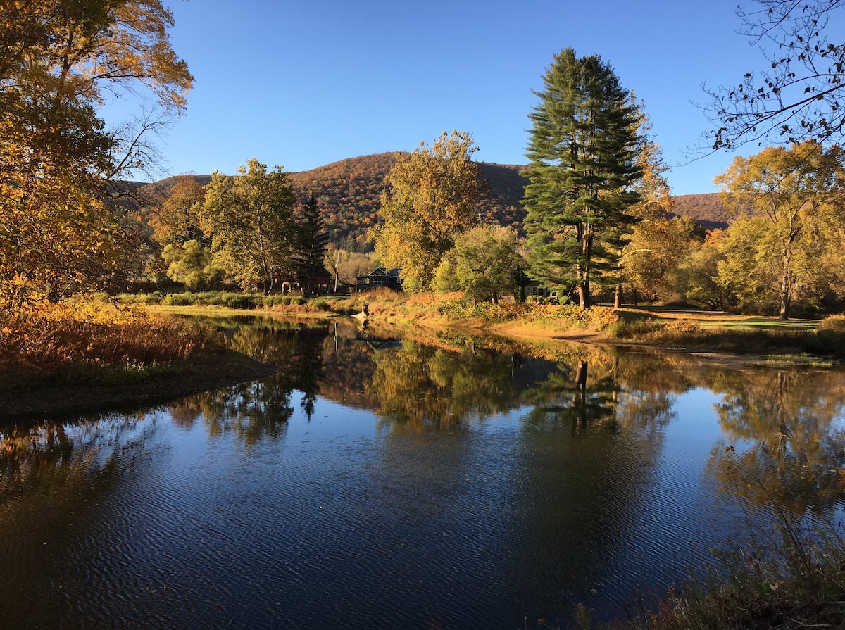
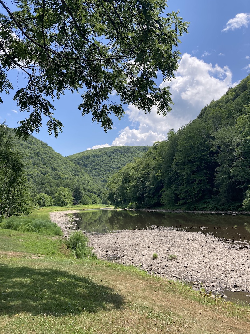
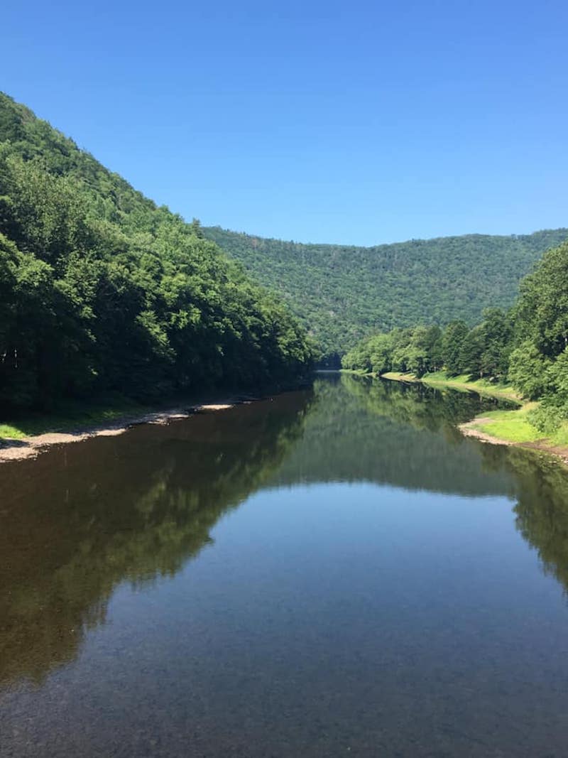
Trailhead to Ansonia, 8 miles
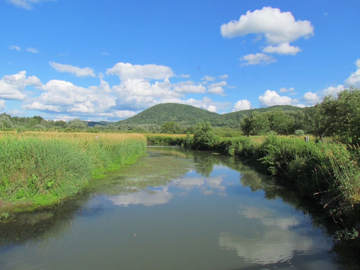
Pennsylvania’s Pine Creek Rail Trail runs along Marsh Creek for its first 8 miles; this shot was taken off-trail from an aging private bridge.
The PCRT kicks off near Wellsboro, PA, a lovely little tourist town of old-fashioned shops, terrific restaurants and generous lodging—though the actual trailhead is tough to find; try plugging in Pag-Omar Farms Market, which stands about 100 yards from the access lot. You might also stop there for drinks, snacks, maps or carry-out lunches; there are no other stores for the first 25 miles of the trail.
This initial leg does not follow Pine Creek, but rather the smaller yet equally charming Marsh Creek. While some find these first miles boring, the surrounding wetlands constitute a bird-lover’s paradise, with more than 150 species to spot. I snapped a photo of my first-ever cedar waxwing here, also sighting herons, geese, ducks, thrashers and the elusive kingfisher.

Cedar waxwing along the Marsh Creek segment of the Pine Creek Rail Trail.
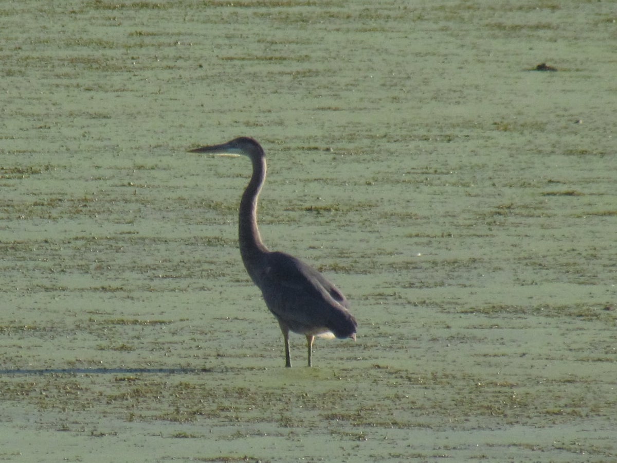
Great blue heron in the Marsh Creek segment of the PCRT.
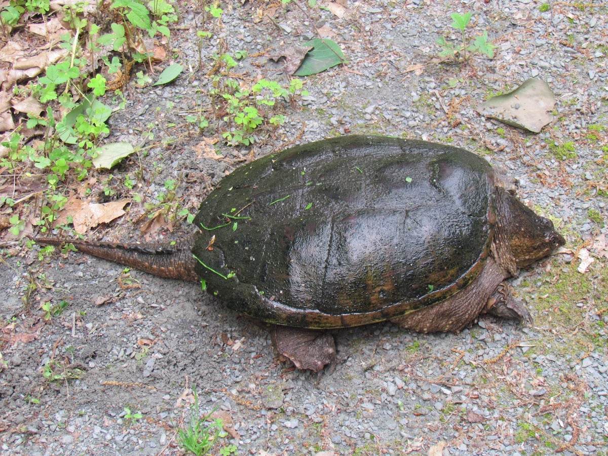
Snapping turtles come up onto the trail itself to lay their eggs beside the path.
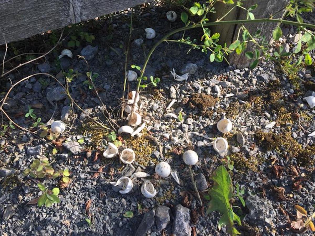
A litter of baby snapping turtles has hatched, leaving behind their temporary homes beneath the PCRT fence.
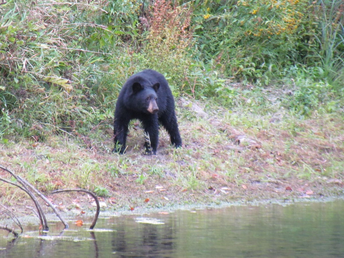
Elsewhere on the trail, look for hawks, ospreys, orioles, turkeys, grouse, hummingbirds and bald eagles. Other wildlife along the PCRT includes raccoons, deer, bears, porcupines, foxes, minks, otters and bobcats.
During spring, watch for snapping turtles crossing the path in this section; they lay their eggs at trailside, and later in the season you’ll find piles of empty shells at regular intervals.
Ansonia to Darling Run, 1 mile
Flowing quietly through golden evening sunlight, Pine Creek (left) swings in from the west to join Marsh Creek just north of Darling Run on the PCRT.
Just off Route 6, Ansonia access—also known as Marsh Creek—is one of more than a dozen parking lots attached to the trail. It’s a great starting-spot, as the next one-mile segment has much to offer:
Visible to the right is headquarters for Ole Covered Wagon, a horse-drawn carriage ride that traverses the trail down to Tiadaghton. That’s possible because the railroad here was double-tracked, with the creek-side path now reserved for the carriage and other horse-riders. (You can bike on it, but it’s rougher than the carefully groomed gravel bike trail—and there’s an elevation difference, making it tricky to cross between the two.)
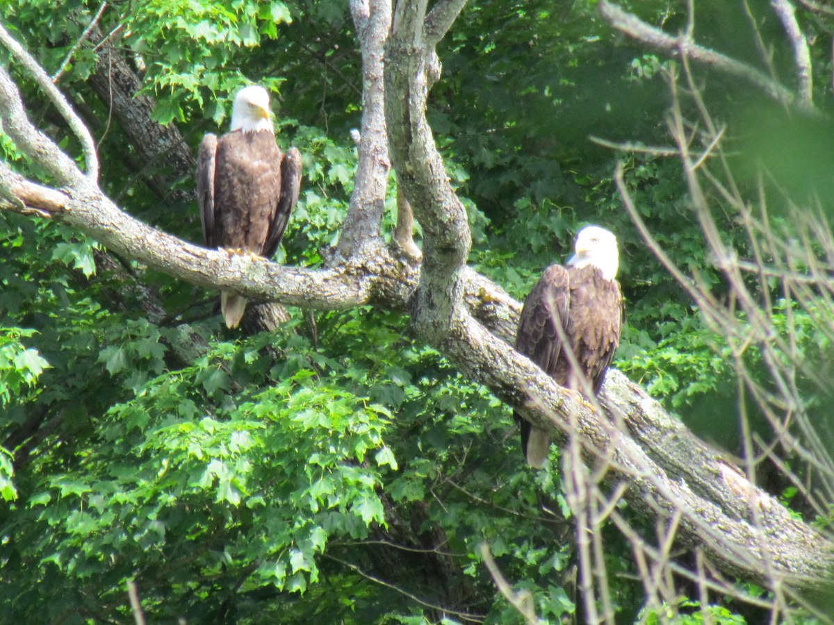
A pair of bald eagles keeps watch on the surrounding woodland; photo taken near the Ansonia access parking lot on the PCRT.
As you leave Ansonia, the PCRT crosses Marsh Creek on the first of eight major bridges—though this is the only one where two trestles run side by side. Then it passes under Route 6, and shortly thereafter Pine Creek joins Marsh Creek from the west, a truly enchanting spot. Just south of this bucolic merger, there’s a well-established eagle’s nest in a conifer across the creek.
Also nearby is Pine Creek Outfitters, which rents all kinds of gear and also provides shuttle services to help with the logistics of one-way biking.
Darling Run to Tiadaghton, 8 miles
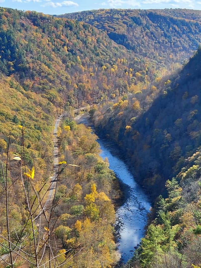
Pine Creek and its accompanying bike-trail seen from Colton Point State Park on the west rim; cliffs here reach nearly 1500 feet.
The Darling Run lot tends to get crowded on weekends, especially in the fall. That’s because the Pennsylvania Grand Canyon starts here, with the tree-clad cliffs climbing close to 1500 feet in some places. This remote area has no cell service as the trail winds along the waterway, which includes several Class III rapids. Kayaks, canoes, rafts and tubes are common, though boaters should check water-levels, which often drop sharply in the summer. Pine Creek Outfitters and Miller’s Store in Morris are among several places that rent watercraft. Bike rentals are likewise available at many local establishments.
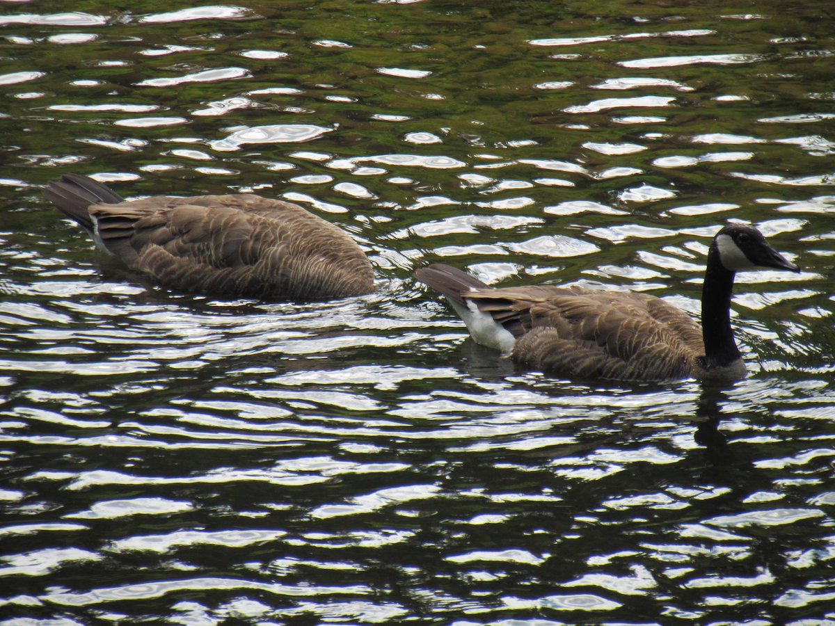
Canada geese floating (and diving) on Pine Creek near Darling Run.
Eight miles south of Darling Run, the PCRT crosses Turkey Path Trail, which climbs both walls of the gorge to scenic outlooks high above. On the eastern or trail side, the steep and occasionally tricky path runs beside several waterfalls, taking about a mile to get up to Leonard Harrison State Park, which offers spectacular canyon views in both directions. Courageous hikers can also ford the creek and take the similarly arduous 1.5-mile ascent to Colton Point on the west rim—with likewise stunning views and somewhat sparser crowds. (Harrison really gets thronged on autumn weekends.)
Along with Turkey Path, the PCRT connects at various points with many other hiking trails—including the scenic West Rim Trail; the 323-mile Mid-State; and the 9-mile Golden Eagle, which Purple Lizard calls “one of the best day-hikes in Pennsylvania.”
Tiadaghton to Blackwell, 8 miles
Bucolic view from Tiadaghton picnic area near mile 16 on the Pine Creek Rail Trail.
The Iroquois name for Pine Creek, Tiadaghton is a solitary waterside spot for swimming, picnics and fishing. I’ve never been here without seeing someone camped in a hammock between its trees; indeed, Tiadaghton is the first of five areas where primitive camping is allowed on the PCRT—but you must get a permit from PA’s Department of Conservation of Natural Resources (DCNR), which oversees the trail. Of these five—including Hoffman, Tomb Flats, Black Walnut Bottom and Bonnell Flats—this is by far the most isolated; it is best reached by bike or hike, as even four-wheel-drive vehicles may have trouble on the steep and treacherous access road.
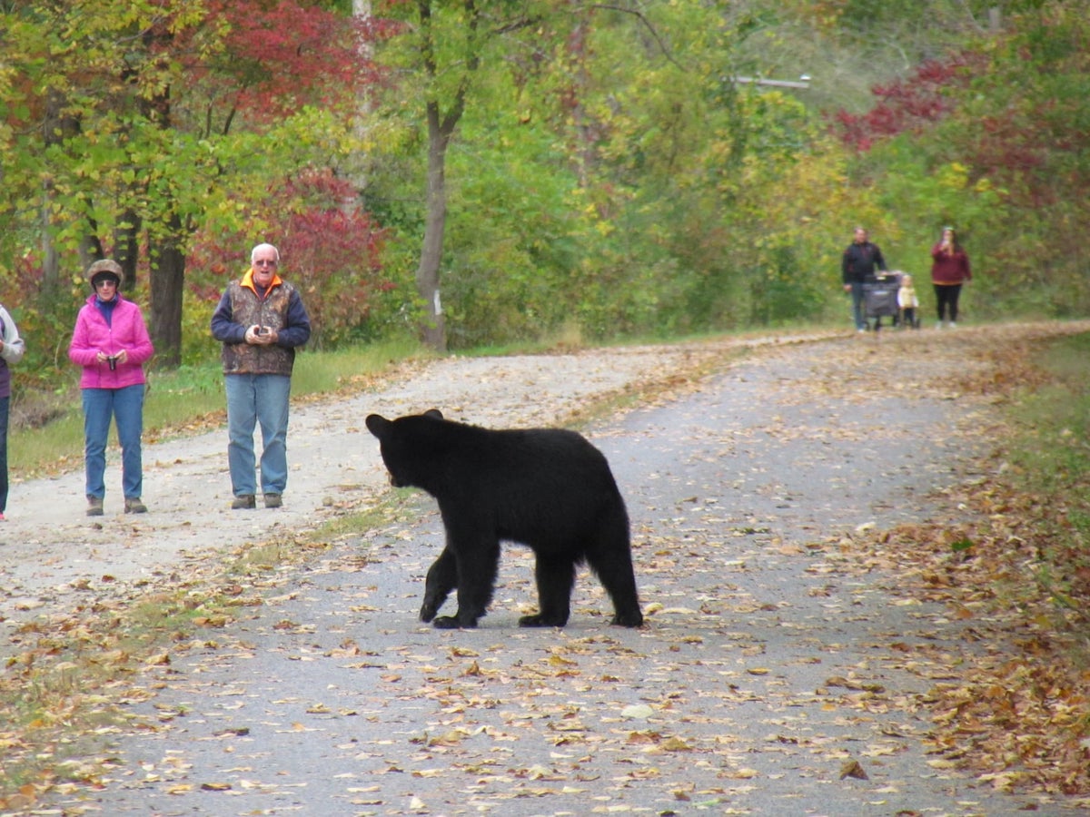
A young bear has wandered onto the PCRT bike-path, somewhat confused by the trail’s other occupants (don’t worry; these hikers are much farther away than they look).
Within seconds, the disconcerted ursine had swum across the creek, glancing back from the opposite shore.
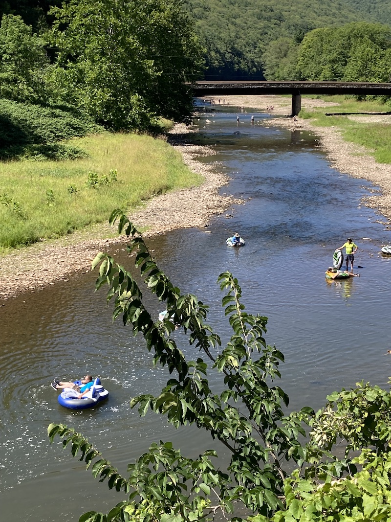
Tubers float peacefully along Pine Creek just south of Blackwell; the bridge in the background is Route 414 crossing the water toward Morris, PA.
Tiadaghton likewise features one of 15 “comfort stations” appearing every few miles along the trail. With flushless toilets that are a step or two above port-a-potties, these stations are spacious, ventilated, well maintained and faced with stone to match the terrain.
South of Tiadaghton the trail remains remote, with slope on one side and creek on the other. Perhaps its most notable aspect is the likelihood of seeing a timber rattlesnake dozing in the sun at the foot of the cliff; my wife and I once photographed a tangle of five beside their den—though one was a garter taking advantage of its venomous cousins for camouflage. I’m sure deadly vipers are no selling point for some readers, but if you leave these retiring creatures alone, they will gladly reciprocate.
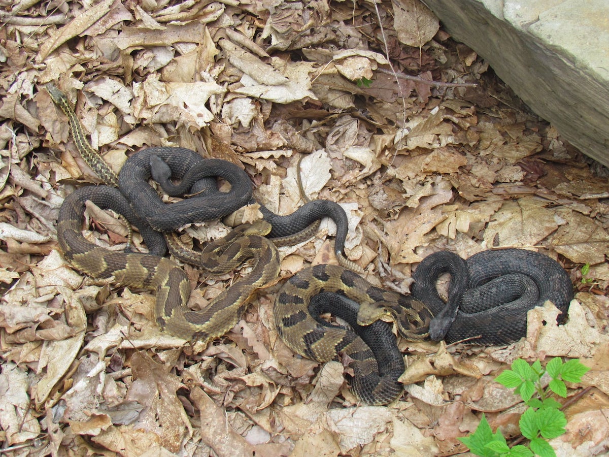
Can you spot the harmless garter hiding among these four timber rattlers? Note that two of the venomous vipers are in black phase, and two are mixed. Photo taken on the PCRT a few miles north of Blackwell.
Next up is Blackwell in the town of Morris, where both sides of the trail’s road-crossing offer a noticeable grade—necessitated by the fact that the train-tracks formerly spanned this road on an overhead bridge.
Here the canyon becomes less pronounced, while civilization reappears in the form of several historic buildings and the disarmingly tiny Miller’s Store. This busy establishment offers drinks, supplies, fresh-cooked eats from a small daily menu and an impressive array of used books; they also rent bikes, some lodging and colorful floating tubes for the creek.
Besides Miller’s and Pag-Omar, other trailside stores include three further south: a general store at Cedar Run, Wolfe’s at Slate Run and McConnell’s in Waterville. All five offer sandwiches and other light fare—plus ice cream.
Blackwell to Slate Run, 10 miles
At roughly two miles, the stretch of PCRT between Blackwell and Rattlesnake Rock is the longest straightaway on this 62-mile bike-path.
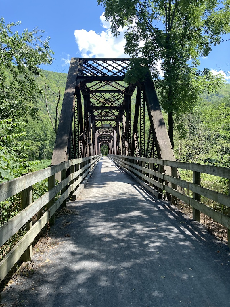
The small lot in Blackwell is intended for boaters and anglers, while generous parking for hikers and bikers is two miles south at Rattlesnake Rock. As Linda Stager notes in her excellent PCRT guidebook, the section from Blackwell to Rattlesnake is, at nearly two miles, the longest straightaway on the trail. This begins at an imposing trestle across the creek (somewhat frustrating, as you cannot see over the sides) and continues through a handsome rock cut with cool stone walls on both sides.
Rattlesnake Rock juts out into Pine Creek, a popular spot for swimming and diving. Named when the region was swarming with snakes, it is now largely free of these vipers. This locale is also one of more than a dozen public access points to the Pine Creek Rail Trail.
Shortly thereafter comes Rattlesnake Rock—a massive outcrop into the water, reached by a path through woods near the lot. Named when the region was literally swarming with snakes, the outcrop is now thankfully viper-free and serves instead as a popular swimming hole, generally bedecked with youngsters diving off the rock.

Fall foliage along the Pine Creek Rail Trail.
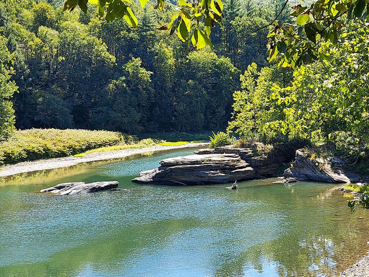
The trail then winds on toward Cedar Run, creeping along beneath the perilously engineered Route 414, which clings to the cliff high overhead—and then crossing an impressive three-span truss bridge with open sides for generous views of the water.
Situated almost exactly at the PCRT’s halfway point, Cedar Run is a tiny but charming village with a general store, a small hotel and restaurant (the Cedar Run Inn)—plus a popular private campground known as Pettecoat Junction.
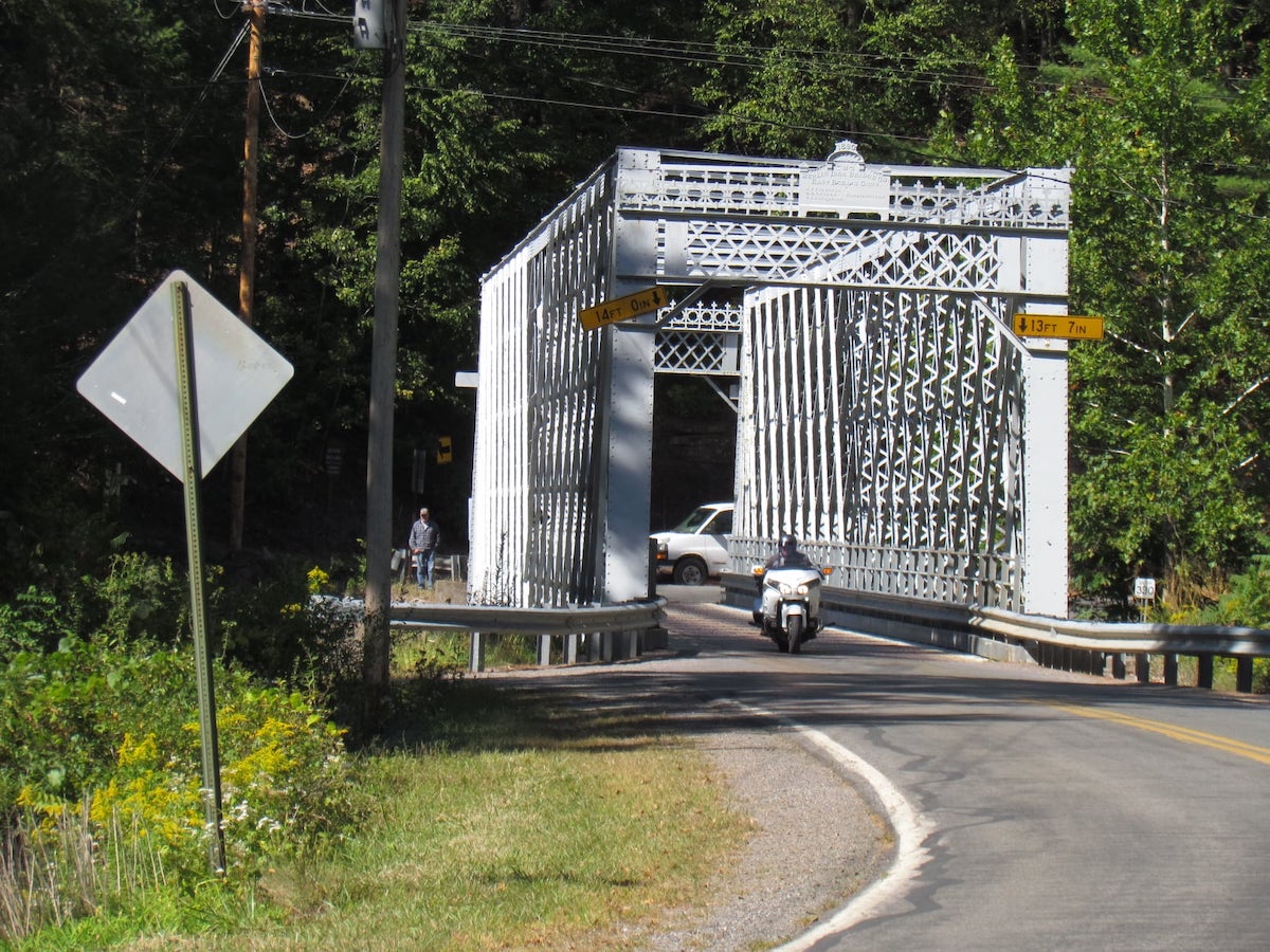
Taking Route 414 across Pine Creek, this historic lattice-truss bridge is located just north of Slate Run, PA. It was built in 1890.
South of Cedar Run, keep an eye out for the road-crossing at mile 34; a few hundred feet to your right on 414 stands a handsome lattice-truss bridge originally built in 1890. It’s a glowing steel gem, well worth a short side-trek for photos.
Slate Run to Waterville, 15 miles
Pine Creek from one of three impressive truss bridges between Waterville and Torbert; once used by the New York Central Railroad, these handsome spans now carry the rail-trail over placid waters.
For bikers needing a rest, Slate Run makes a perfect overnight break. Not only does it have a general store, but also, its Hotel Manor offers cozy rooms, plus a restaurant overlooking the creek.
Other trailside lodging is available at Miller’s and the Cedar Run Inn, along with the later Waterville Tavern, plus plenty of hotels in both towns where the trail begins and ends. And there are numerous cabins and bed & breakfasts throughout the area; my wife and I just love Bear Lodge near Wellsboro.
As it happens, Pine Creek’s most famous fishing area starts here, running south for three miles below Slate Run. Nicknamed “The Stretch,” it is, in the words of fishing guide and photographer William Kosmer, “a catch-and-release section of water that is supplemented with large brown trout stocked by Slate Run Tackle Shop’s Brown Trout Club.
“While other parts of the stream are open to harvest (consult your fishing regulations for specifics), most anglers in the area release their catch, which allows for year-round fishing.”
Kosmer adds that trout-fishing is best in spring and early summer; that smallmouth bass and the occasional walleye can likewise be caught; and that several Pine Creek tributaries also offer good fish, especially when the mainstream gets too warm.
Heading on to Waterville, keep an eye out for Tomb Flats, with another good swimming hole. Just past Tomb, there’s a tiny, tough-to-find pioneer cemetery with tilting tombstones hidden in the weeds, some dating back to the 1850s. Look for a small footpath on the right curving off toward two large trees.
Tiny footpath winds off the PCRT immediately south of Tomb Flats; here there’s a pioneer cemetery with tilting tombstones hidden in the grass, some dating back to the 1850s.
The rest of this long stretch alternates between heavy forests and sunny segments where a two-lane highway slices between trail and creek. Watch for Wolf Run (marked with a sign), where the Golden Eagle Trail sets off—and where an abandoned stone-arch bridge stands next to the bike-path’s tiny trestle. It’s worth noting here that many of these “runs” passing under the trail are dry in summer.
Waterville to Jersey Shore, 12 miles
One of three truss bridges that take the PCRT over Pine Creek a few miles north of Jersey Shore, PA.
The small but thriving Waterville Tavern is the third of only four restaurants accessible from the PCRT; our fourth will be the Venture Inn, nine miles farther south. All have widely varying hours, so make sure to check before counting on meals. My wife and I also love Santino’s Pine Creek Inn along Route 44 below Waterville, though it is not actually on the trail.
The coolest thing about this segment is three magnificent truss bridges in the space of eight miles, all offering majestic views of the waterway.
Shortly after the third of these spans, Pine Creek pulls away to the west and is generally not visible from the bike-path. As you near trail’s end in Jersey Shore (of which, more soon), watch for sheer rock walls on your left, with one eye-catching face where the leveled striations have been pushed up so far they run perpendicular to the ground.
Folks not from Central PA are often surprised to hear of Jersey Shore, which should logically be located four hours east; but in fact, the bustling town was named after a clan that settled here from that Atlantic state.
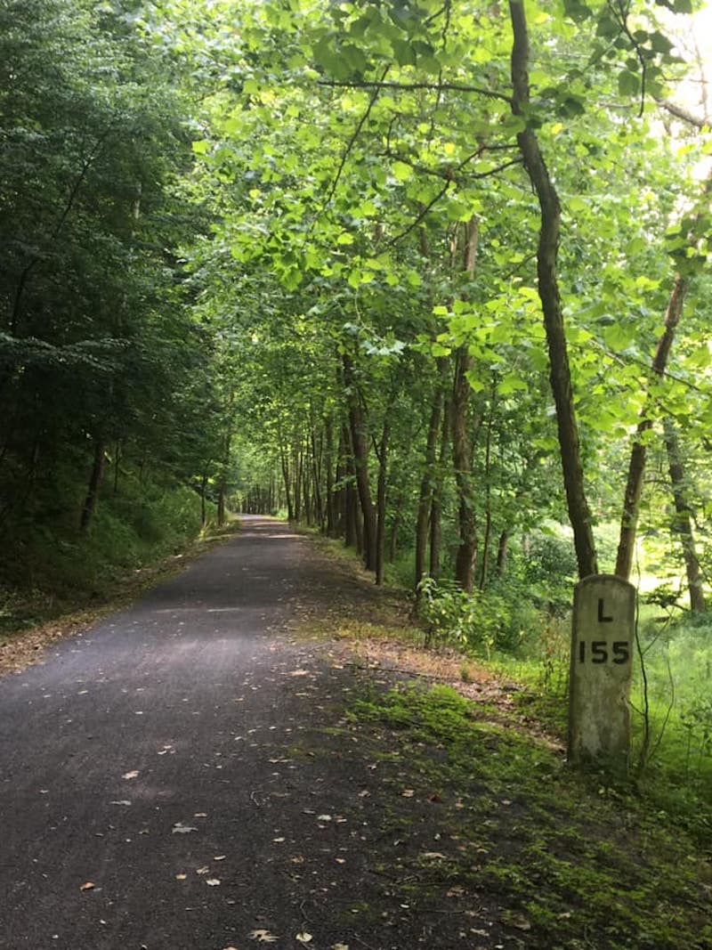
One of many extant mileposts along the Pine Creek Rail Trail in Central PA. Erected by the once-mighty New York Central Railroad, they indicate distance to the NYC’s former headquarters in Lyons, NY (hence the “L”).
Past the rock walls, look to your right for a small stretch of original train-track lying in the weeds. As we near the end, these ties and rails call forth gratitude to the long-defunct Jersey Shore, Pine Creek and Buffalo Railroad, the first train line through this area. Opened in 1883, it carried lumber down from the 145 sawmills with which this valley was once packed. Eventually the line was taken over by the mighty New York Central and then Conrail, which made its last run here in 1989.
A mile from Jersey Shore, the trail crosses four-lane Route 220 on a screened-over bridge, thereafter making its only extended climb; then comes the final parking lot, where a dignified old NYC caboose marks the end of the train—wups, I mean trail.
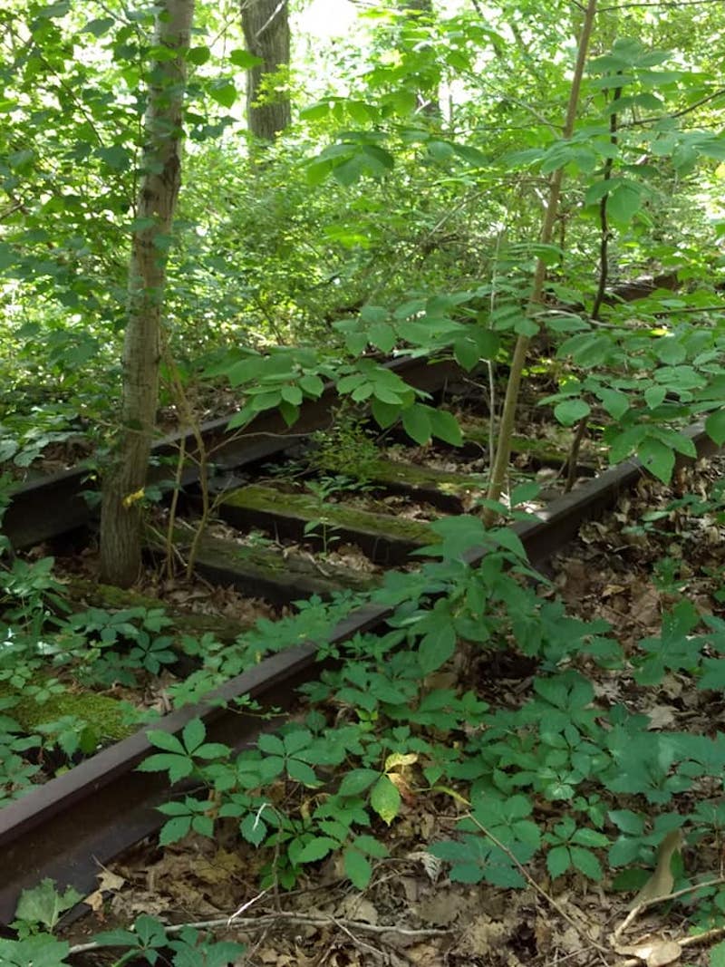
Aging set of train tracks beside the Pine Creek Rail Trail just north of its terminus in Jersey Shore, PA; the popular biking path owes its origins to several railroads that once ran lumber down the heavily wooded Pine Creek Valley.
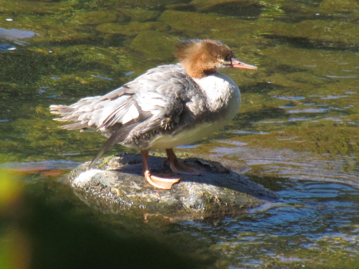
A merganser suns itself in the middle of Pine Creek, photographed from the bike-path along the shore.
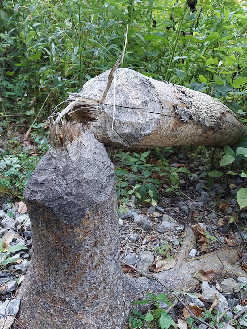
That was no axe! This tree felled beside the Pine Creek Rail Trail shows every sign of attention from a very busy beaver.
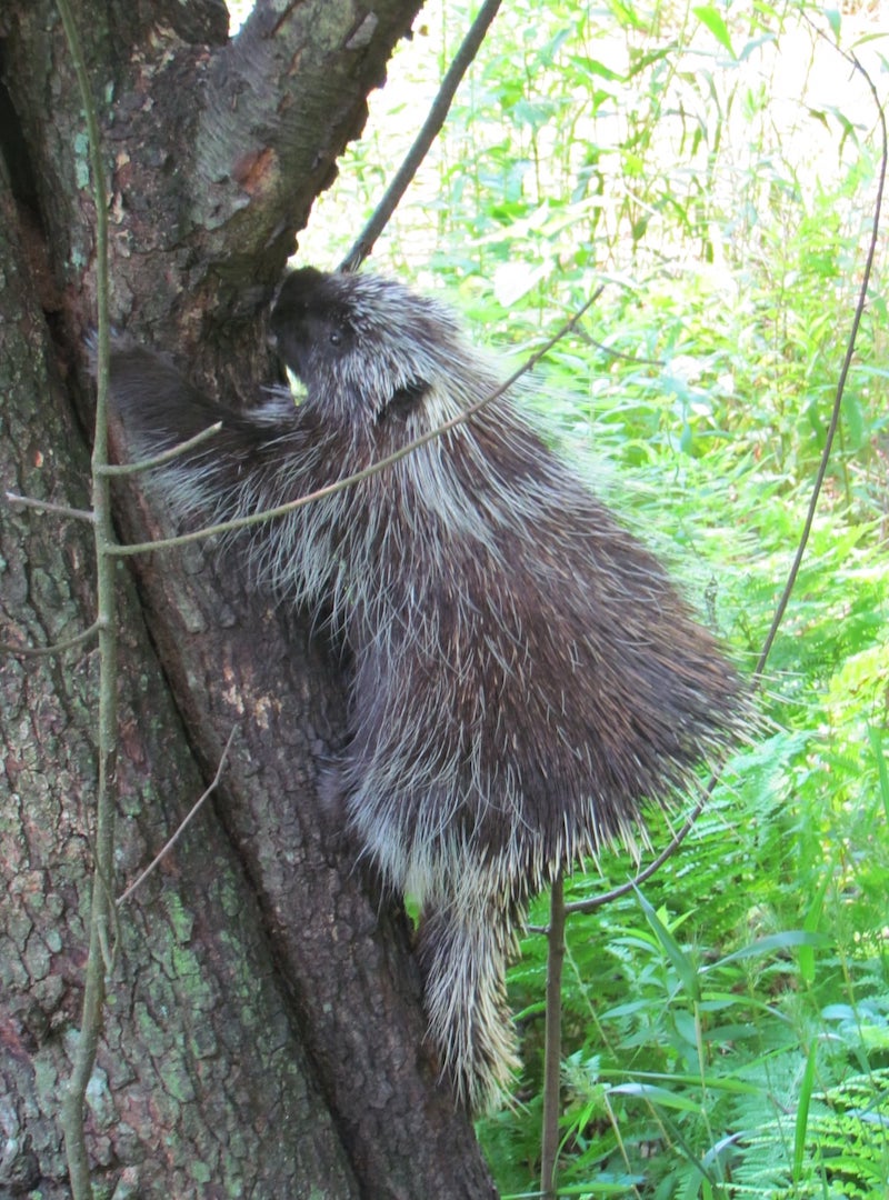
A somewhat unsociable porcupine climbs away from the photographer; photo taken along the Pine Creek Rail Trail.
Maps and Legends
Newcomers should start with a map—either from Purple Lizard, or the free ones produced by DCNR. These latter are available at some stores along the trail—or downloadable online (you can Google “elibrary DCNR pine creek map” to learn more).
Those seeking more info cannot do better than Linda Stager’s authoritative Pine Creek Rail-Trail Guidebook (2015). For history of the valley and its people, grab David Ira Kagan’s wonderfully informative Pine Creek Villages (2009), part of Arcadia’s wide-ranging, sepia-toned series called Images of America.
Happy trails.
About the Author
Joseph W. Smith III is a writer, teacher and speaker in Central PA. Published in several websites and periodicals, Joe has also penned books on Hitchcock, the Bible, church life and under-the-radar movies—along with a volume of Great Jokes and Riddles. He plays trumpet in a community band; reads 100 books a year; serves as officer in his local church; struggles to keep cheering for the Buffalo Bills; listens to music whenever not sleeping; and maintains a small collection of unused postcards. He can be reached at robbwhitefan@gmail.com.All images courtesy of the author.
FOLLOW US ON INSTAGRAM


Information published on this website and across our networks can change over time. Stories and recommendations reflect the subjective opinions of our writers. You should consult multiple sources to ensure you have the most current, safe, and correct details for your own research and plans.