
What You Need to Know for Hiking the Kokoda Track of Papua New Guinea
By: Mike Coleman
Skip to Section
Based in Papua New Guinea, the Kokoda Track traverses about 96 km In the southeastern part of the country. It starts at Owers’ Corner (about 50 km east of Papua New Guinea’s capital Port Moresby), runs through the Owen Stanley Range, and ends in the small village of Kokoda in Oro Province.
The Kokoda Track has a fascinating history and is a popular trail for adventurous trekkers worldwide. Let’s learn a bit more about it!
History of the Kokoda Track
Before it gained international significance, the Kokoda Track was a network of paths and trails used by the region’s indigenous peoples for centuries.
The trail connected communities across the rugged Owen Stanley Mountain Range, allowing for trade, communication, and social interaction among different groups. Indigenous people traveled these trails to exchange goods like shells, meats, and other items not readily available in different ecological zones. And today, many communities still live along the route and maintain traditional ways of life.
The Kokoda Track held significant strategic importance during World War II. After the attack on Pearl Harbor and the fall of Singapore, the Japanese Empire was advancing south toward Australia. As part of this campaign, Japanese forces aimed to take Port Moresby to cut off Australia from its ally, the United States, and to provide a launching point for a potential invasion of Australia.
In July 1942, Japanese forces landed on the north coast of Papua New Guinea and began their overland advance towards Port Moresby, primarily along the Kokoda Track. With the aid of local Papuan carriers, the Australian forces mounted a series of defensive actions along the track.
The fighting along the Kokoda Track was among the most brutal of the Pacific War. The track traverses rugged, mountainous terrain and dense jungle, and the soldiers had to contend with not only each other but also harsh conditions, including heavy rain, mud, and tropical diseases. The battle was marked by desperate, close-quarters fighting, with neither side giving ground easily.

By November 1942, Australian and American forces were able to halt the Japanese advance and then push them back along the track. The battle effectively ended Japan’s attempt to take Port Moresby and marked a significant turning point in the Pacific campaign. The Battle of Kokoda, as it’s sometimes called, played a vital role in halting Japan’s southern advance in the Pacific.
Today, the Kokoda Track is a place of pilgrimage for many, particularly Australians, who come to pay their respects to soldiers who fought and perished there.
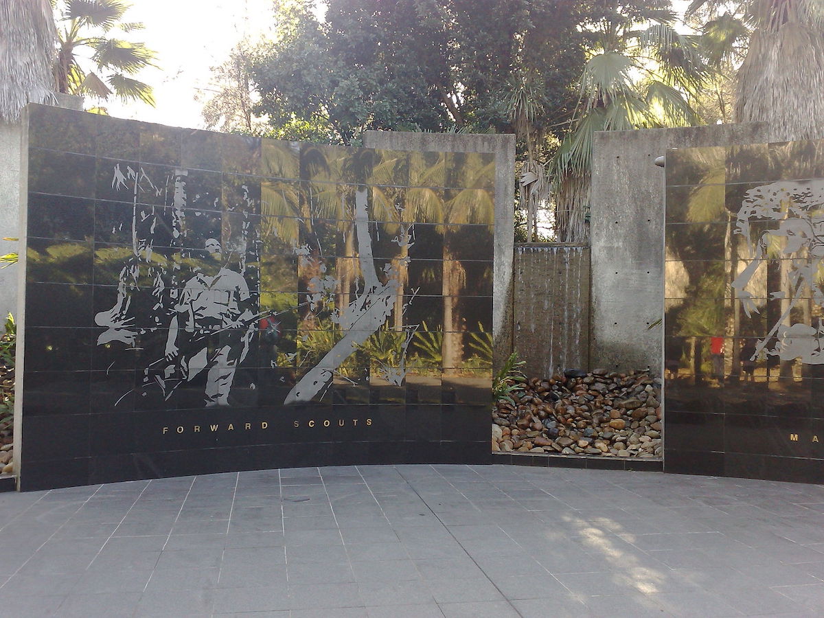
Photo by Chiefmanzzz on Wikimedia Commons
Points of Interest Along the Kokoda Track
There are several notable points of historical and cultural interest along the Kokoda Track, including:
- Owers’ Corner: The traditional starting (or ending) point of the Kokoda Track for most trekkers, located approximately 50 kilometers from Port Moresby. There’s a war memorial here dedicated to the soldiers who fought in the Kokoda campaign.
- Imita Ridge: This is the last ridge before descending to Owers’ Corner. During the war, it was the final defensive line for the Australians. If the Japanese had breached this point, they would have had a clear path to Port Moresby.
- Goldie River: This is typically the first major river crossing for those starting from Owers’ Corner.
- Isurava Memorial: One of the most significant war memorials along the track, the Isurava Memorial is the site of one of the critical battles of the Kokoda campaign. The memorial features four granite pillars inscribed with the words Courage, Endurance, Mateship, and Sacrifice.
- Eora Creek Village: The site of a WWII battlefield, it’s now a peaceful village where trekkers can stop for the night.
- Templeton’s Crossing: Named after Captain Sam Templeton, Commanding Officer of B Company, the 39th Battalion. This is the site where he was last seen during the retreat to Isurava in July 1942.
- Mount Bellamy: At an elevation of about 2,200 meters, it’s the highest point on the Kokoda Track.
- Efogi Village: The largest village along the Kokoda Track and roughly the halfway point of the trek.
- Menari Village: A scenic village known for its large, flat airstrip.
- Bomana War Cemetery: Located near Port Moresby, it’s one of the largest war cemeteries in the Pacific, with nearly 4,000 graves, most of whom were soldiers in the Australian forces who died in the Kokoda campaign.
Hiking the Kokoda Track
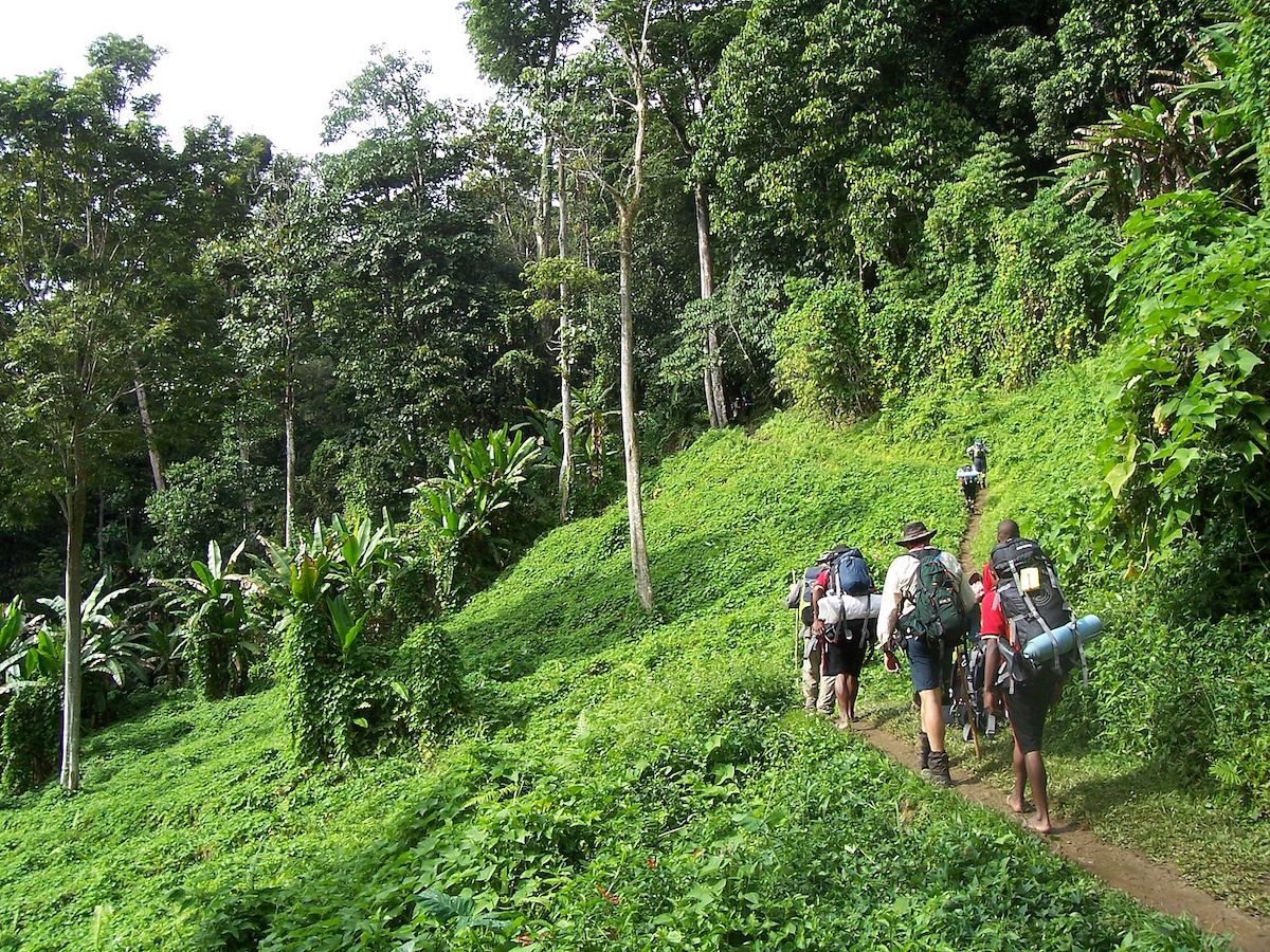
Hiking the Kokoda Track is not for the faint of heart. It’s one of the world’s more challenging treks, and will test the physical and mental strength of even experienced hikers.
As you hike the Kokoda Track, you’ll encounter several different types of terrain. For most of it, you will be in the mountains of the Owen Stanley Range, with lots of steep ascents and descents, often with very muddy and slippery conditions. You also must make your way through dense tropical rainforest, encountering thick vegetation and large tree roots. As well, there are numerous rivers and small streams along the Kokoda Track, and depending on the time of year and the weather conditions, these waterways can range from shallow and easy to cross to deeper, fast-flowing rivers that require care and skill to navigate.
This area of Papua New Guinea experiences a wet season (December through March) and dry season, and temperatures can vary significantly between day and night and at different altitudes along the trail. It can be an incredibly dangerous undertaking if you’re not adequately prepared with the right clothing, gear, and lots of water.
While the Kokoda Track is approximately 96 km long, the actual amount of distance you may hike could be closer to 160 km, due to the winding trails and rugged ascending and descending terrain. Most hikers complete the track between four and 12 days, depending on their physical fitness levels, how difficult crossings may be due to weather, and the pace they’d like to set. There are many stops along the way of historical and cultural significance, and of course abundant natural beauty.
While hiking the Kokoda Track, you’ll see towering trees draped in lianas and epiphytes, various species of palms, and an undergrowth filled with ferns and large-leafed shrubs. Orchids are also commonly found in this region, including the world’s tallest orchid, Grammatophyllum speciosum, known as the giant orchid, the tiger orchid, and the sugar cane orchid. At higher elevations, the vegetation changes to montane forests and grasslands with tree ferns, mosses, and other species adapted to cooler temperatures.
While the animals along the track can be a bit difficult to spot, you may find yourself face-to-face with tree kangaroos and bandicoots—there are also hundreds of species of birds here, like kingfishers, parrots, and others. You may also spot various species of frogs, snakes, lizards, and even freshwater crocodiles.
If you’re interested in learning more about the Kokoda Track, here are a few additional resources:
- Kokoda Track Authority
- National Museum of Australia: Kokoda Trail
- Australian Government Department of Veterans’ Affairs: About the Kokoda Track—1942 and Today
About the Author
Mike is a writer who researches and shares actionable advice around travel lifestyle, finance, and personal growth. He loves any trip where he can explore the great outdoors, and believes everyone should be able to experience travel for personal development and fulfillment. Read his other articles on Frayed Passport here.Featured image by David Maunsell on Unsplash
FOLLOW US ON INSTAGRAM


Information published on this website and across our networks can change over time. Stories and recommendations reflect the subjective opinions of our writers. You should consult multiple sources to ensure you have the most current, safe, and correct details for your own research and plans.