Can You Visit Death Valley National Park in the Summer? We Did!
By: Sarah Stone
Skip to Section
Have you been to a place so different from what you know that it feels like another planet? Or maybe you have a destination in mind that you’re stuck on—someplace you find totally fascinating, and that you have to see for yourself.
Death Valley is one of those places for me.
I love all of our National Parks, and hope to visit each one of them someday. And as a Floridian, the Everglades holds that top spot as my favorite of the 63 US National Parks—but Death Valley is the one that always transfixed me, probably because it’s so completely different from the Everglades.
The Everglades is hot, but it’s not 130-degrees-hot.
The Everglades is right about at sea level, whereas Badwater Basin in Death Valley is 282 feet below it.
The Everglades is a dense wetland filled with biting, stinging, lurking things (which I actually adore!), whereas Death Valley…could not be described as lush, but it does have biting, stinging, lurking things.
Well, my husband Dave and I traveled out to Las Vegas for a couple of shows in late June, and we had to see if it was possible to visit the hottest place on earth—not to mention the lowest elevation and driest destination in North America.
Was it a dumb decision to go in the summer?
Well, not for us—but it might not be your cup of tea.
Keep reading for highlights!
Planning Our Day in Death Valley
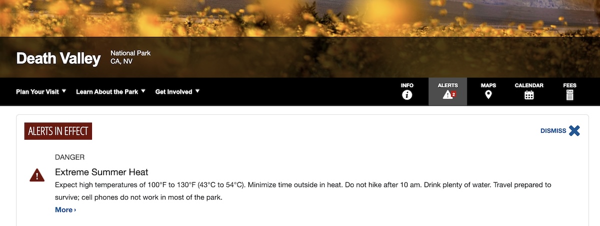
Extreme Summer Heat alert for Death Valley on the NPS website.
Almost immediately when I began researching visiting Death Valley during the summer, I got a little freaked out—there are big red warnings on the National Park Service website saying not to hike after 10am, to come to the park prepared to survive, and that cell phones generally don’t work in most areas.
The closer we got to the trip, the more I bit my nails thinking, “Should we do something else that day? It’s just one day…but are we being stupid?”
Visions of “Florida Man and Wife Missing in Death Valley” headlines swam through my head. I really, really didn’t want to be that couple.
I compiled a list of recommendations (gathered from the National Park Service as well as other guides and personal stories from fellow travelers) for where to go in the park, how far each stop was from the Visitor Center, whether the roads in those areas were paved or not, and how much time we should expect to spend at each location.
Looking at maps and reading stories and guides to the park helped set my mind at ease. We’d be driving to each of our spots, not hiking between them. We wanted to see several major areas of the park instead of concentrating on one locale and exploring further than we were comfortable. We were staying on marked roads and trails, dressing appropriately, and bringing tons of water and snacks.
And yet we had an inauspicious start to the trip: the key fob to our rental car had a low battery and no physical key, locking us out of the vehicle multiple times before heading to the park. Not wanting to get stranded with a dead fob, Dave exchanged cars at the rental agency…and with that, we were on our way to Death Valley National Park!
Furnace Creek
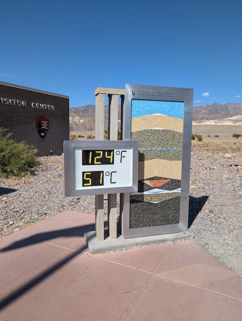
We stepped out of the car at the Visitor Center and were greeted by a sign saying it was 124 degrees out—accompanied and emphasized by a blast of wind that felt quite literally like opening a furnace.
But it wasn’t so bad?
It did not feel at all like what I’d imagine 124 degrees would be like—or at least it’s very, very different from the heat in Florida precisely because it’s a dry heat. This was aggressive but it wasn’t oppressive.
Dave loved comparing the “feels like” temperatures—in Florida, we’ll see “90 but feels like 102” whereas in Death Valley, it was more like “120 but feels like 95.” It was a bit of a relief to both of us—”It doesn’t feel worse than home!”
We stopped in to pick up a physical map, ask a few questions, and grab some souvenirs before the Visitor Center closed. We asked about stargazing and one of the rangers recommended we stay for the moonrise, and pointed out a few spots perfect for viewing the night sky. (By the way, don’t you just love talking to rangers, volunteers, and everyone else working at the National Parks? They’re always the coolest, friendliest, most helpful people.)
Zabriskie Point
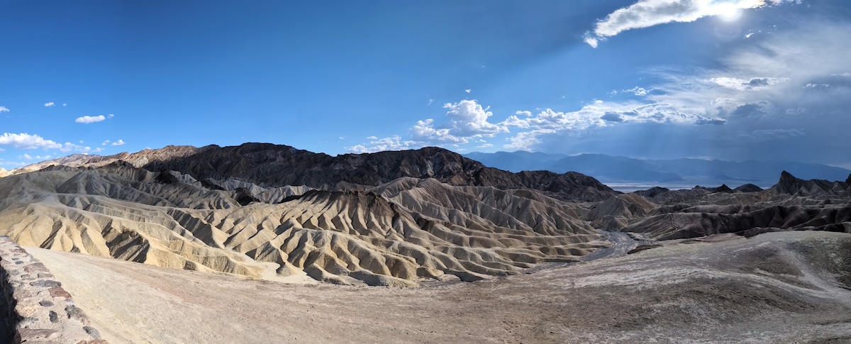
Panorama of the landscape from Zabriskie Point.
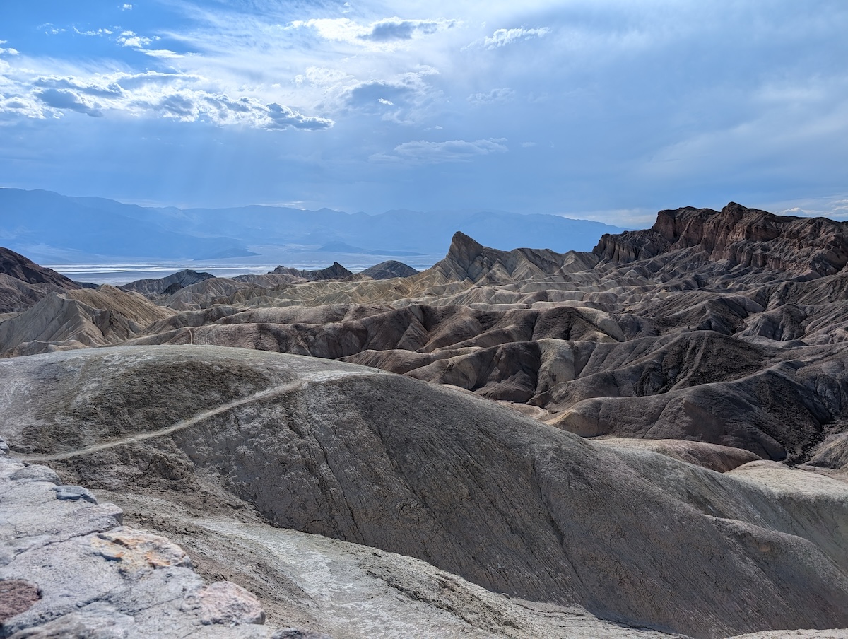
A view of the rippling rocks at Zabriskie Point.
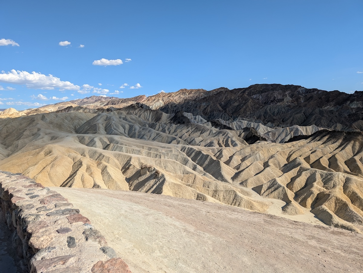
Bright gold hills seen from Zabriskie Point.
Our first stop after the Visitors Center was Zabriskie Point, which is one of the most well-known spots in Death Valley. It’s also the last place we saw other visitors for quite a while.
This spot is named for Christian Brevoort Zabriskie, who was vice president of the Pacific Coast Borax Company in the early 1900s. After borax (a mineral that’s used in detergents, cleaners, cosmetics, glass, and much more) was discovered in Death Valley in the 1880s, Harmony Borax Works was established locally to produce and move the product to the Pacific Coast Borax Company’s refinery in Alameda. We visited what’s left of the Harmony Borax Works plant later in the day.
We walked up the small, zig-zagging hill of Zabriskie Point and took in the views of Golden Canyon and the badlands. The yellow, rippling hills looked like something from a sci-fi movie, and the stillness of everything despite the wind never letting up was remarkably surreal.
Twenty Mule Team Canyon
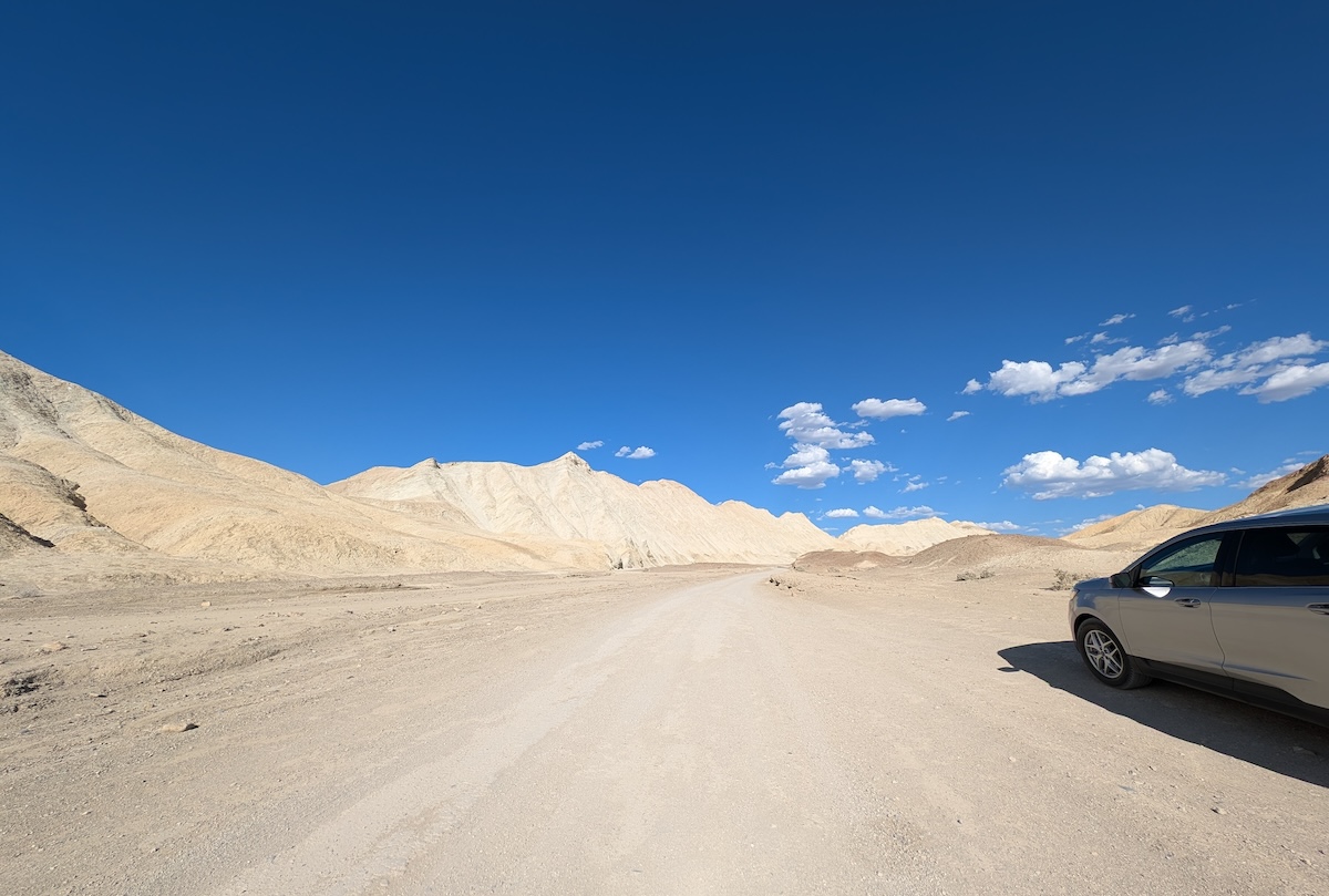
One section of the drive along Twenty Mule Team Canyon.
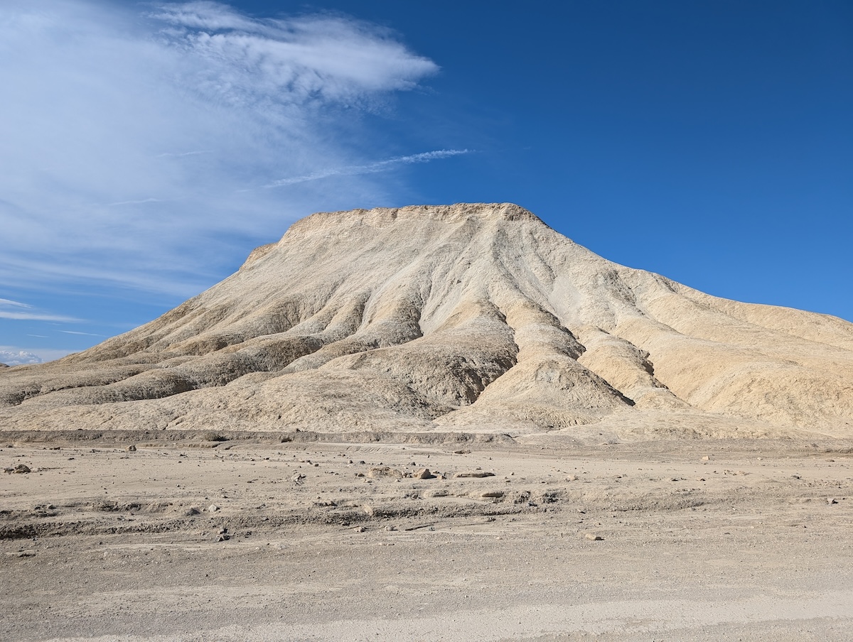
One of the views along Twenty Mule Team Canyon.
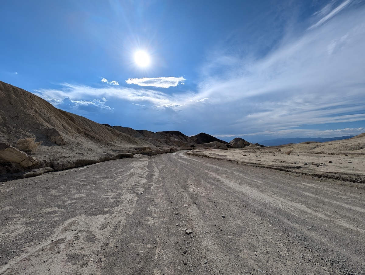
Another view of the drive along Twenty Mule Team Canyon.
We then took a short drive along the short, unpaved road of Twenty Mule Team Canyon. This is named for the teams of 18 mules and two horses that transported enormous wagons of borax from Death Valley to the nearest railroad, over 160 miles away through desert terrain. These teams hauled more than 20 million pounds of borax out of Death Valley over the course of six years.
And here’s some fun travel trivia: parts of Star Wars Episode VI were filmed here—you may recognize the road as the one leading to Jabba’s palace!
Golden Canyon
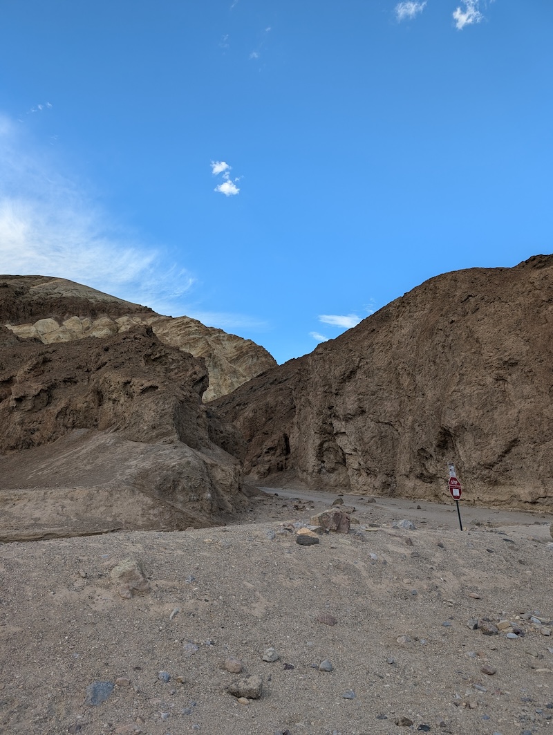
The entrance to Golden Canyon.
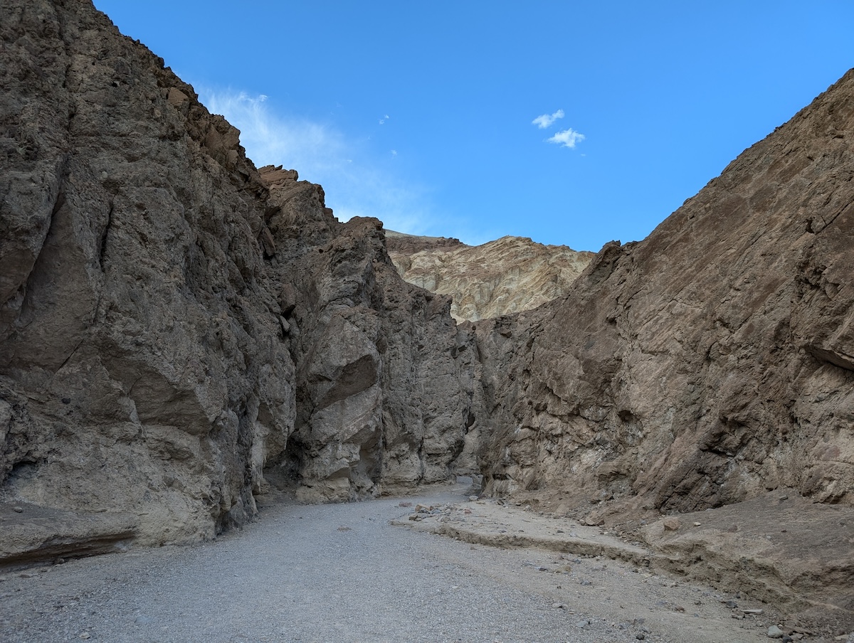
The trail just beyond the entrance to Golden Canyon.
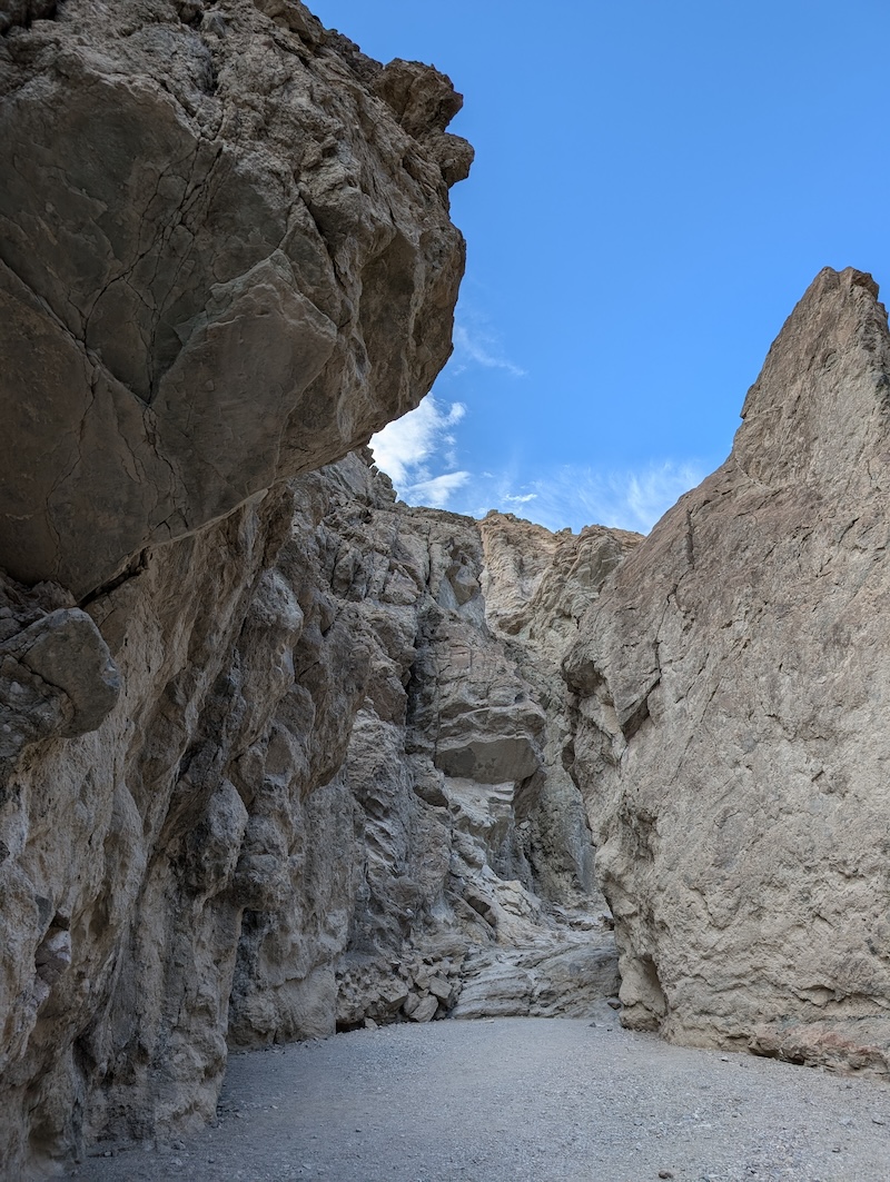
One of the many quiet, secluded spots along Golden Canyon.
We didn’t have Golden Canyon on our original list of spots to check out, but as we passed it, we decided to stop for a quick peek inside.
I’m so glad we did.
Although there were only a handful of visitors at Death Valley National Park that day, this area felt more secluded than others.
You can’t see how winding and branching the trails are through Golden Canyon from the parking area—about 20 feet in, it felt like we’d been transported to someplace else entirely. The constant gusts of wind stopped and all we could hear was ourselves. We were surrounded by light yellow rock walls with myriad nooks and crannies, and while we were tempted to take the two-mile hike through the canyon, we turned back to tour Artists Drive while the day was still bright.
Artists Drive
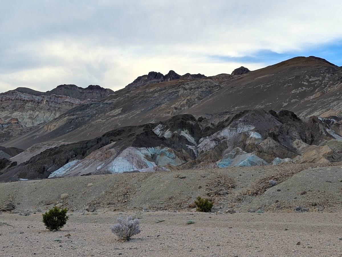
The beautiful teal Artists Palette hills.
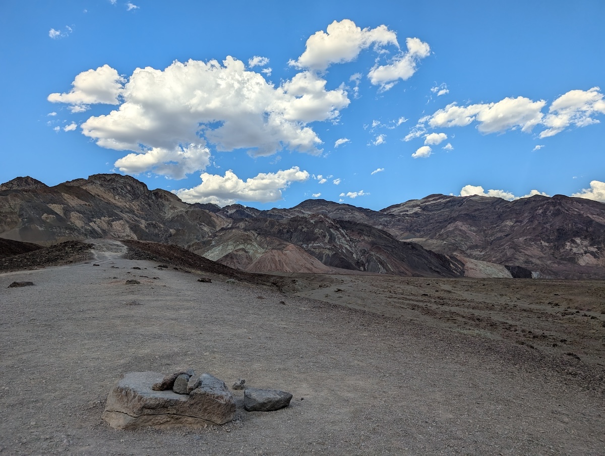
A view from Artists Drive.
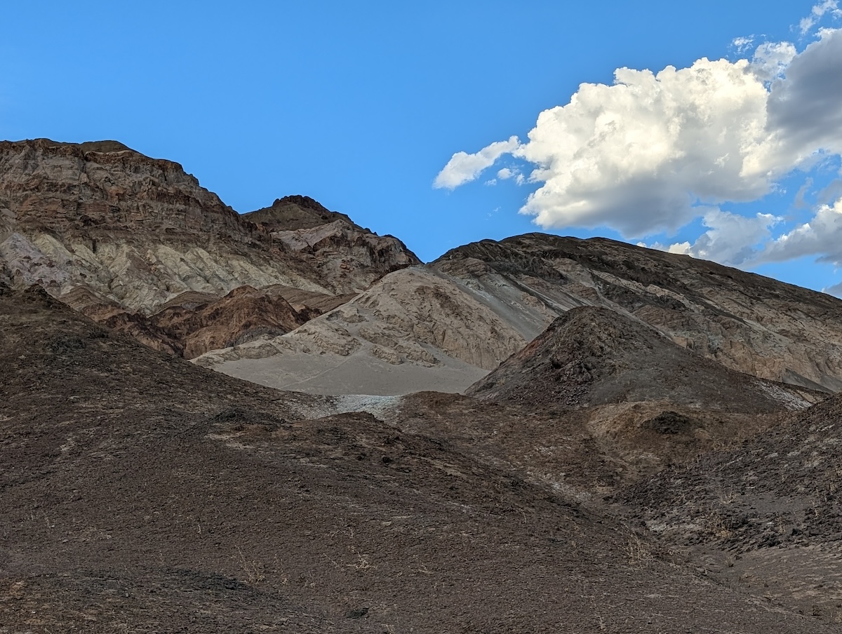
Another view from Artists Drive.
Artists Drive is nine miles of paved road surrounded by striped, multicolored, jagged hills. The further we traveled through this area, the more adventurous the road got: hairpin turns, tight corners around rock formations, and dips we could barely see over the hood of our car, making it feel as though we were either going to launch into space or fall into oblivion.
All the while, I was thinking, “Every turn is different—every single thing we look at is just different from whatever we’ve seen so far.”
I suppose I’d interpreted descriptions of unchanging desert in part to mean that the landscape is very…samey.
That’s not the case in the slightest. Absolutely nothing looks like anything else in Death Valley—it’s breathtaking. Rippling hills, striped mountains, craggy canyons…and that’s before we got to Devils Golf Course or Badwater Basin.
Just as I was meditating on this, we came across something that truly stood out: the famous teal blue Artists Palette hills, colored so due to volcanic activity and oxidation of iron, mica, and manganese. The hills were so brightly pigmented, they looked like they were covered in color powder.
Devils Golf Course

Panorama of Devils Golf Course.
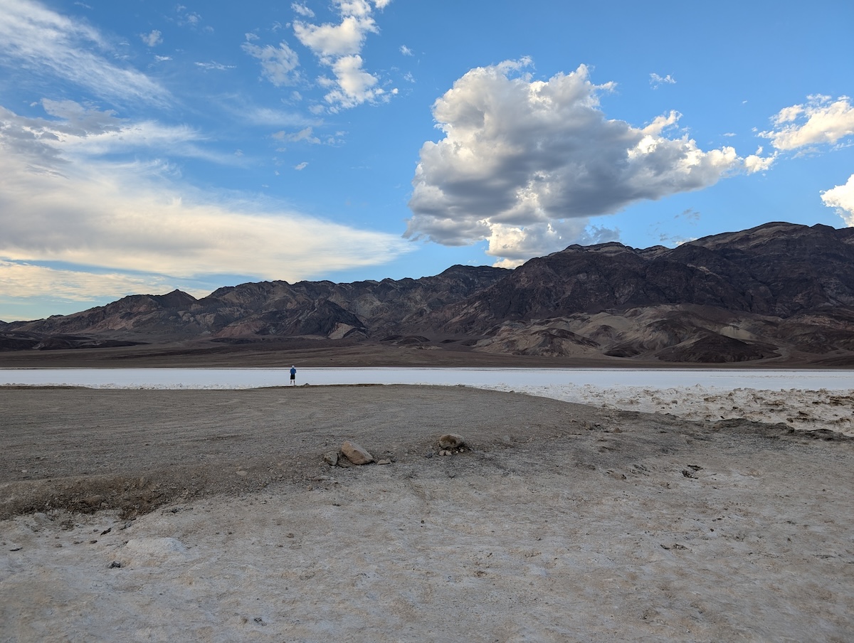
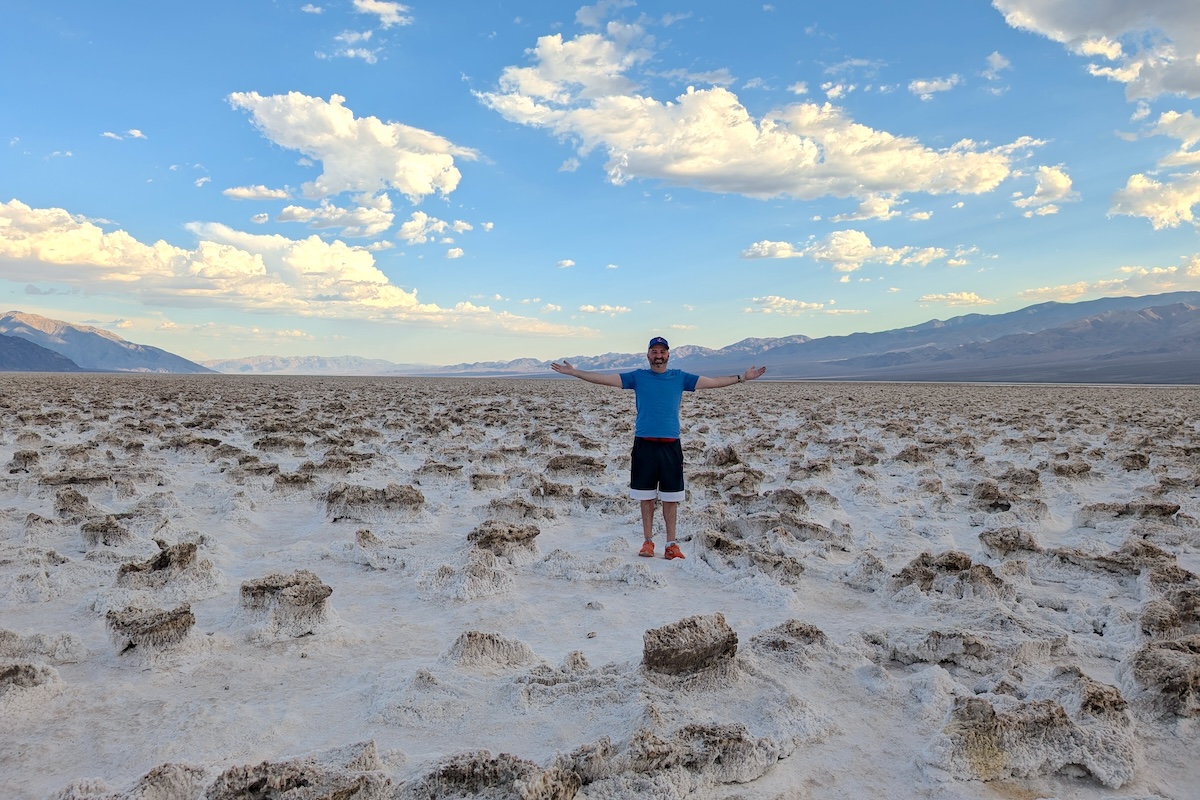
Dave at the edge of Devils Golf Course.
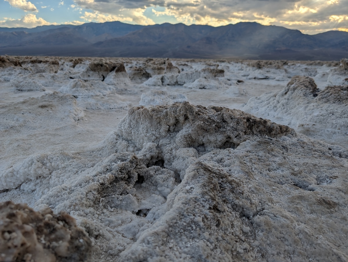
A close-up of the jagged formations at Devils Golf Course.
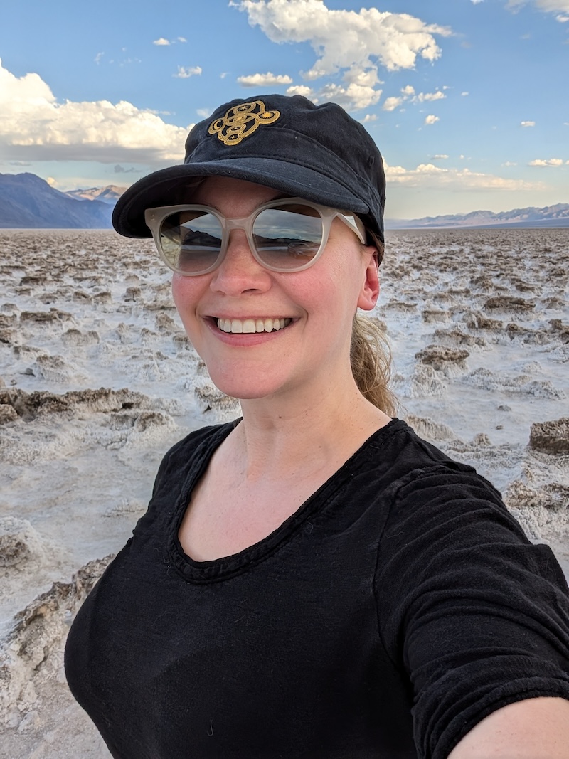
I was delighted to see Devils Golf Course!
Devils Golf Course was the first of two major spots I wanted to see in Death Valley National Park. This area is a huge swath of rock salt that’s been shaped and eroded over the years by wind and rain until the mineral deposits became jagged and spiny, jutting out of the ground, hard and angry looking.
Signs in the parking lot said to be very careful walking into Devils Golf Course—tripping and falling here can cause serious injuries, like broken bones. We gingerly stepped out into the terrain from the gravel parking area, not knowing how sturdy the ground was, but found it was quite solid. The formations were similarly tough, but porous enough in some spots that it was easy to imagine how quickly someone could lose their footing and fall straight into this bed of thorns.
Badwater Basin
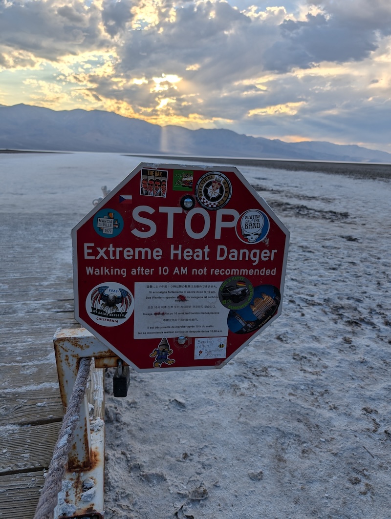
Extreme heat warning sign at Badwater Basin, covered in stickers.
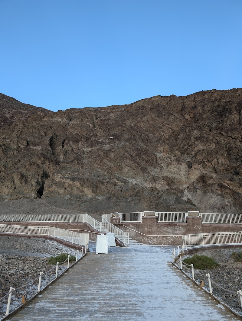
The boardwalk at Badwater Basin—that small white strip about two-thirds of the way up the hill shows the sea level.
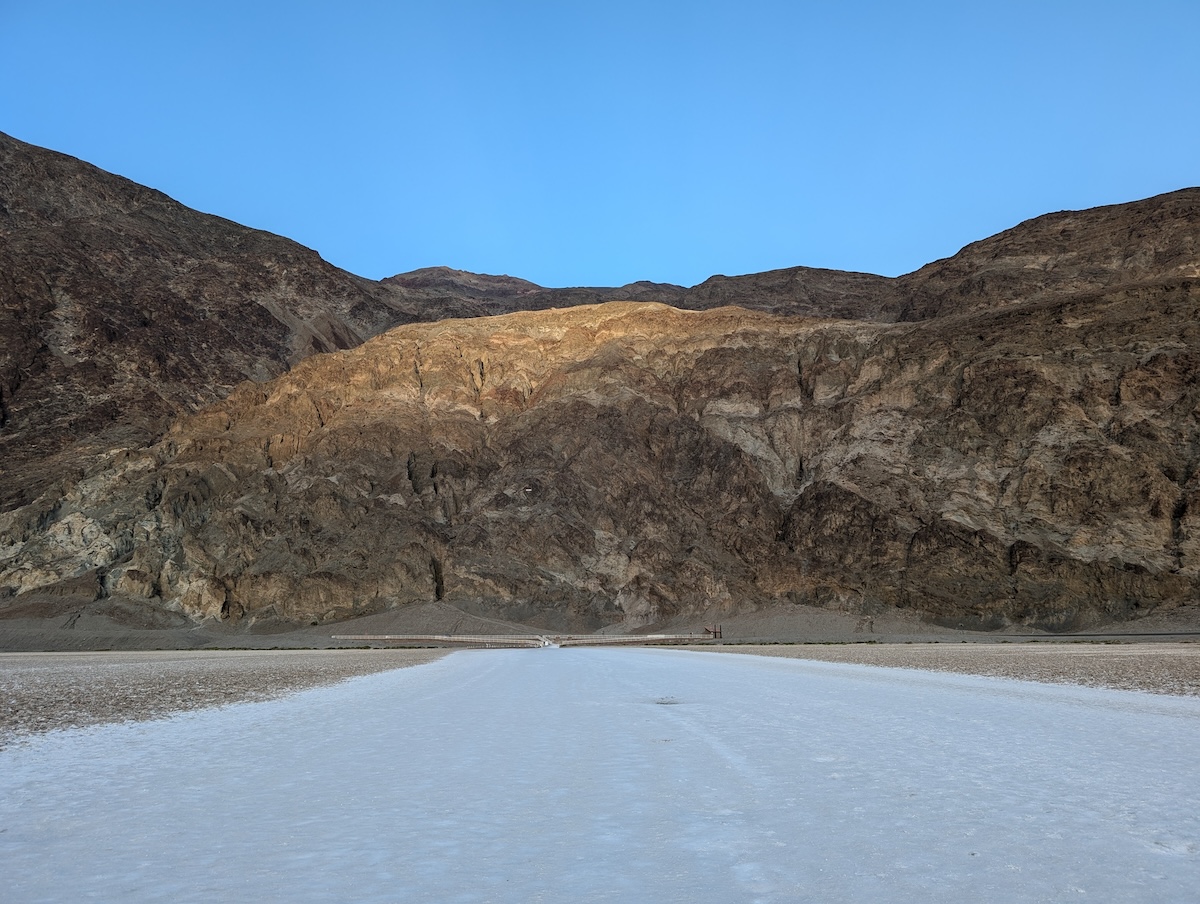
Looking back toward the boardwalk from Badwater Basin.
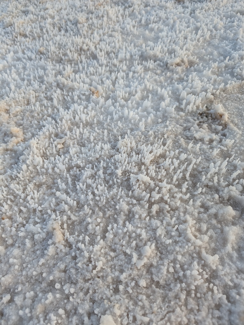
Some of the interesting salt formations at Badwater Basin—these were soft and slushy, unlike the hard, rocky formations at Devils Golf Course.
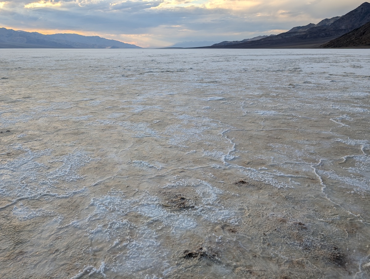
The beautiful salt polygons at Badwater Basin.
Badwater Basin was the second major spot I wanted to visit in Death Valley. With the lowest elevation in North America, it sits 282 feet below sea level—to provide a visual of how deep that is, there is a small white sign high up on the hills next to the basin showing where sea level is. It’s striking to see in person; we think nothing of being a few hundred feet above sea level, but below it? It’s jarring.
The area is a flat—the remains of a lake that evaporated tens of thousands of years ago—composed of salt, calcite, gypsum, and borax, and the brackish smell hit us before we arrived at the parking area. There was one other person at the boardwalk when we got there: the first visitor we saw since leaving Zabriskie Point some hours earlier.
We walked out onto the flats, which had a completely different feel from the ground at Devils Golf Course (or anywhere else we’d been in Death Valley, for that matter). This was hard packed salt, but much softer than the formations at Devils Golf Course, and less crystallized. In some areas, the ground resembled sand or a new snow, with water underneath. There were small holes where visitors had dug around before we arrived, and someone had written “Grateful Dead” with their finger in a slushy, sandy part of the ground recently—we weren’t the only ones at Death Valley who’d been to the Dead & Company shows at the Sphere that weekend.
As we ventured further out into the middle of the flat, it became a meditative experience. It didn’t feel terribly hot out there, and the stillness and emptiness of this massive open space was hypnotizing. It felt as though we’d only walked for five minutes before we reached the basin’s gorgeous salt polygons—created when groundwater rises up and evaporates through the mineral deposits—a bit over a mile beyond the boardwalk. I could have spent the rest of the afternoon and night there.
But we had a sunset to catch.
Harmony Borax Works
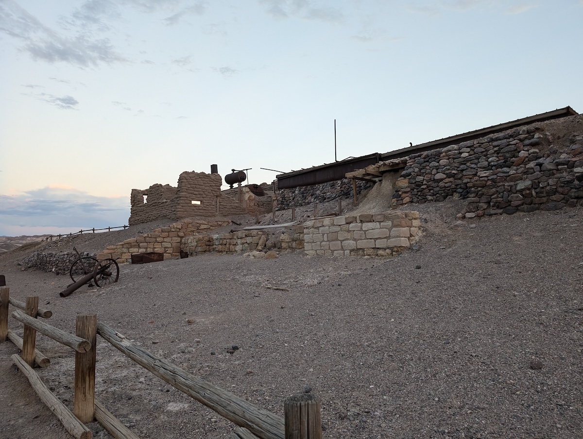
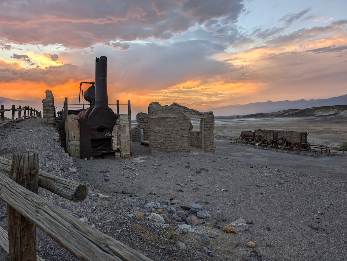
Remains of the Harmony Borax Works.
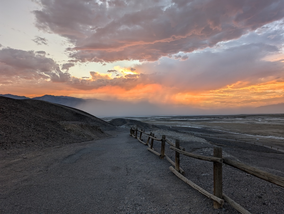
The walkway at Harmony Borax Works—part of this gravel path had been washed away recently.
Dust storm in the distance from the Harmony Borax Works.
The Harmony Borax Works was our final daylight stop in Death Valley National Park. The plant here was built in 1881 and employed 40 people, mainly Chinese laborers, and produced three tons of borax every single day for five years. This is also where the twenty mule teams came in, to haul the product to the railroad for shipping. What remains of the site is now on the National Register of Historic Places.
We arrived just as the sun was beginning to set, and as with most other areas of the park, we were the only visitors there. We explored the ruins of the plant and the old mule team cart, which once carried loads up to 36 tons across 165 miles of desert. Parts of the gravel walking path were washed out, and the remains of the old plant sat still and quiet—a little eerie.
We didn’t get to watch the sunset as we’d planned here: the wind picked up again, and brought with it a storm of salt and dust from Badwater Basin and the surrounding areas. We jumped into the car just as the dust hit, turning everything we saw gray and muted.
Dantes View
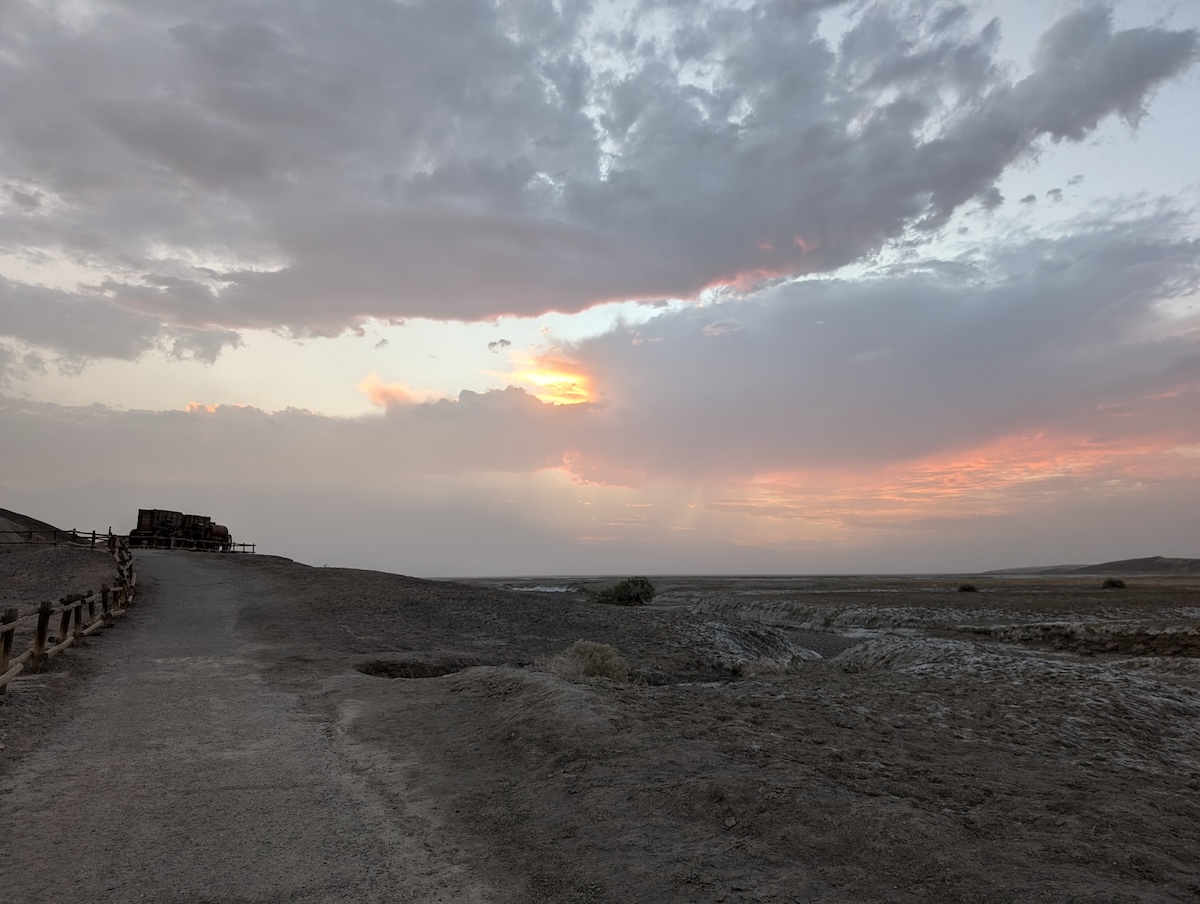
The best view we could get of the sunset through the approaching small dust storm at Harmony Borax Works, before heading to Dantes View.
We didn’t see the sunset through the dust, but the show we got afterward was incredible.
Our last stop in Death Valley was Dantes View—5,575 feet above sea level now, overlooking the white flats of Badwater Basin.
There was one other couple who had the same idea as us: stargazing! Death Valley is a Gold Tier Dark Sky Park, meaning it has so little light pollution that you can see the natural night sky about as well as it appeared before urbanization. Dark Sky areas are fantastic for astronomy, education, and exploration, and they’re important for other things too, like conservation.
We lay down on a bench and watched as the sun finally sank below the horizon and the stars began to come out. After a while there was just a faint glow of Las Vegas in the distance with thousands of visible stars overhead. We used a night sky manual and app to identify constellations, planets, and interesting stars, and we pointed out satellites as they passed overhead. A few meteors zoomed by and the Milky Way lit up half of the sky.
We didn’t take pictures here. But on our way out, we watched the moon rise over the desert, and I took one last photo.
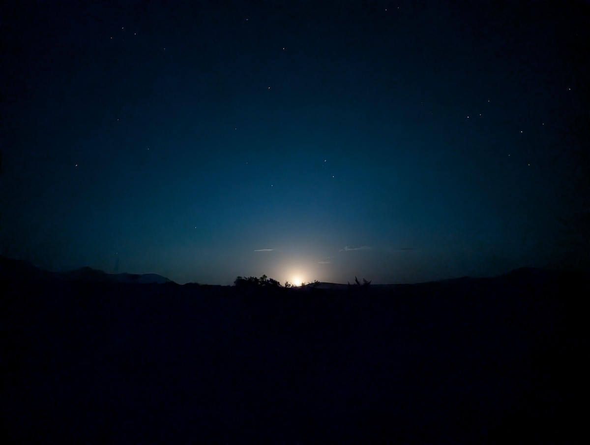
Moonrise at Death Valley National Park.
About the Author
 As the editor-in-chief of Frayed Passport, my goal is to help you build a lifestyle that lets you travel the world whenever you want and however long you want, and not worry about where your next paycheck will come from. I've been to 20+ countries and five continents, lived for years as a full-time digital nomad, and have worked completely remotely since 2015. If you would like to share your story with our community, or partner with Frayed Passport, get in touch with me using the form on our About page.
Information published on this website and across our networks can change over time. Stories and recommendations reflect the subjective opinions of our writers. You should consult multiple sources to ensure you have the most current, safe, and correct details for your own research and plans.
Frayed Passport is a participant in the Amazon Associates Program, an affiliate advertising program designed to provide a means for sites to earn advertising fees by advertising and linking to Amazon.com. We also may share links to other affiliates and sponsors in articles across our website.
